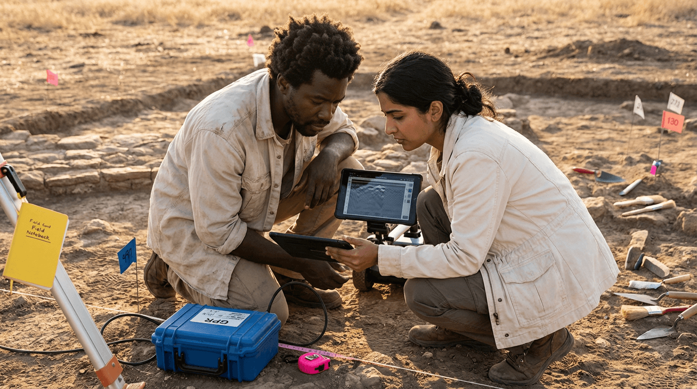
Ground-Penetrating Radar (GPR) Training
This course equips participants with essential skills in ground-penetrating radar (GPR) for conducting surveys in historic river valleys. Learners master GPR fundamentals, survey planning, data acquisition under varying soil conditions, processing into 2D/3D formats, anomaly interpretation for features like foundations and graves, and ethical reporting to support targeted, non-invasive investigations in geology and geography projects.
from 4 to 360h flexible workload
valid certificate in your country
What will I learn?
Acquire hands-on expertise in Ground-Penetrating Radar (GPR) to design and execute surveys in river valley environments, covering grid layouts, antenna choices, field safety, and metadata protocols. Understand soil impacts on signals, process 2D/3D data visualizations, analyze anomalies from buried structures and graves, and create ethical reports for precise, low-impact follow-up actions.
Elevify advantages
Develop skills
- Design GPR surveys by planning grids, line spacing, and antenna configurations for specific targets.
- Collect GPR data through safe and efficient field operations with comprehensive metadata recording.
- Process GPR profiles by cleaning, filtering, and converting data into clear 2D and 3D visualizations.
- Interpret subsurface anomalies to identify graves, foundations, and natural geological features.
- Report GPR findings with documentation of uncertainties, ethical considerations, and recommendations for stakeholders.
Suggested summary
Before starting, you can change the chapters and the workload. Choose which chapter to start with. Add or remove chapters. Increase or decrease the course workload.What our students say
As suas aulas são perfeitas. Adquiri o pacote de um ano e, finalmente, tenho a oportunidade de acompanhar diversos temas do meu interesse sem precisar mudar de plataforma... agradeço por tudo o que fazem, já recomendei vocês a outras pessoas...

Giulio CarloAluno de Marketing Digital
Eu gosto de como as lições são direto ao ponto e como eu consigo alterar capítulos e pular conteúdos que não preciso.

Mariana FerresAluna de Fotografia
Gosto do conteúdo e do modo de apresentação e transcrição de vídeos, o que acelera o processo!

Luciana AlvarengaAluna de Design de Unhas
A plataforma é rápida, simples de usar. A diversidade de conteúdo e os vídeos complementares ajudam muito no aprendizado.

Giulio CarloAluno de Engenharia de Prompt
FAQ
Who is Elevify? How does it work?
Do the courses have certificates?
Are the courses free?
What is the course workload?
What are the courses like?
How do the courses work?
What is the duration of the courses?
What is the cost or price of the courses?
What is an EAD or online course and how does it work?
PDF Course