Ground-Penetrating Radar (GPR) Training
Master ground-penetrating radar for real-world surveys in river valleys. Learn GPR principles, survey design, data processing, and ethical reporting to map foundations, graves, and buried features with confidence in geology and geography projects.
flexible workload from 4 to 360h
valid certificate in your country
What will I learn?
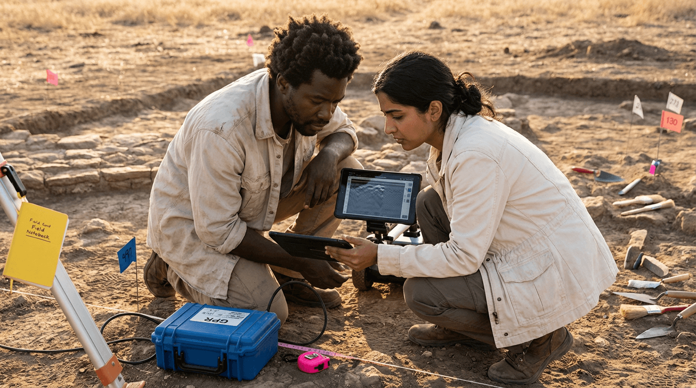
This Ground-penetrating Radar (GPR) Training gives you practical skills to plan and run efficient surveys in historic river valleys, from grid design and antenna selection to safe field procedures and accurate metadata. Learn how soil conditions affect signal behavior, process and visualize 2D and 3D data, interpret anomalies linked to foundations and graves, and produce clear, ethical reports that guide targeted, minimally invasive follow-up work.
Elevify advantages
Develop skills
- Design GPR surveys: plan grids, line spacing, and antenna setups for targets.
- Collect GPR data: run safe, efficient field campaigns with solid metadata.
- Process GPR profiles: clean, filter, and slice data into clear 2D and 3D views.
- Interpret subsurface anomalies: distinguish graves, foundations, and natural features.
- Report GPR results: document uncertainty, ethics, and next steps for stakeholders.
Suggested summary
Before starting, you can change the chapters and workload. Choose which chapter to start with. Add or remove chapters. Increase or decrease the course workload.What our students say
Your classes are perfect. I purchased the one-year package and finally have the chance to follow several topics I'm interested in without needing to switch platforms... I appreciate everything you do, I've already recommended you to others...

Giulio CarloDigital Marketing Student
I like how the lessons are straight to the point and how I can switch chapters and skip content I don't need.

Mariana FerresPhotography Student
I like the content and the way the videos are presented and transcribed, which speeds up the process!

Luciana AlvarengaNail Design Student
The platform is fast and easy to use. The variety of content and the supplementary videos really help with learning.

Giulio CarloPrompt Engineering Student
FAQ
Who is Elevify? How does it work?
Do the courses have certificates?
Are the courses free?
What is the course duration?
What are the courses like?
How do the courses work?
What is the duration of the courses?
What is the cost or price of the courses?
What is an EAD or online course and how does it work?
PDF Course